
- Overview
- Trip Outline
- Trip Includes
- Trip Excludes
- Gallery
- Reviews
- Booking
- FAQ
The Shira Route is a difficult route that begins in the west, at Shira Gate. What is unque about Shira is that the first section of the trail is not hiked, but rather driven. Therefore, climbers using Shira will miss out on hiking up one of Kilimanjaro’s ecological zones, the rain forest.
An off road vehicle transports climbers to the Shira gate, located at 11,500 feet, where the hike begins to Simba Camp. This is a sizable altitude gain for someone who slept at Moshi or Arusha on their previous night. Complications from altitude can occur due to failed acclimatization.
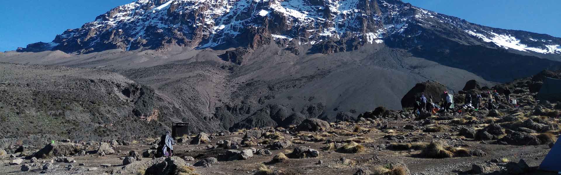
The route takes six days minimum to complete, although seven days is recommended. The descent is down Mweka, in the south-east. Because the starting point is far from Moshi and Arusha, it is more expensive to climb this route due to the added transportation cost of getting climbers to the gate. Scenicaly, Shira is beautiful because it crosses the spectacular Shira Plateau, and then combines with the Machame route to share its viewpoints around the southern circuit. Shira has low traffic until it combines with Machame.
Shira is ideal for those who are confident in their ability to acclimatize to altitude, and to walk over steeper paths for extended periods.
Day 1
Shira Gate to Simba Camp
Elevation: 11,800 ft to 11,800 ft
Distance: 4 km
Hiking Time: 1-2 hours
Habitat: Heath
We depart Moshi for Londorossi Gate, which takes about 4 hours; here we will complete entry formalities while guides and porters prepare equipment. We then continue to drive up a steep path to the Shira Gate where we will begin the hike. The trek starts through shrubs and giant heather until we reach Simba Camp.
Day 2
Simba Camp to Shira 2 Camp
Elevation: 11,800 ft to 12,500 ft
Distance: 6 km
Hiking Time: 2 hours
Habitat: Heath
Today is a fairly easy day to help with acclimatization. We begin by exploring the grassy moorland and volcanic rock formations on the plateau. Then we take a scenic path to the Shira Cathedral, a huge buttress of rock surrounded by steep spires and pinnacles, before settling at Shira 2 Camp.
DAY 3
Shira 2 Camp to Lava Tower
Elevation: 12,500 ft to 15,190 ft
Distance: 7 km
Hiking Time: 4-5 hours
Habitat: Alpine Desert
Lava Tower to Barranco Camp
Elevation: 15,190 ft to 13,044 ft
Distance: 3 km
Hiking Time: 2-3 hours
Habitat: Alpine Desert
We continue to the east up a ridge and then head southeast towards the Lava Tower – a 300 ft tall volcanic rock formation. We descend down to Barranco Camp through the strange but beautiful Senecio Forest to an altitude of 13,000 ft. Although you begin and end the day at the same elevation, the time spent at higher altitude is very beneficial for acclimatization.
DAY 4
Barranco Camp to Karanga Camp
Elevation: 13,044 ft to 13,106 ft
Distance: 5 km
Hiking Time: 4-5 hours
Habitat: Alpine Desert
We begin the day by descending into a ravine to the base of the Great Barranco Wall. Then we climb the non-technical but steep, nearly 900 ft cliff. From the top of the Barranco Wall we cross a series of hills and valleys until we descend sharply into Karanga Valley. One more steep climb up leads us to Karanga Camp. This is a shorter day meant for acclimatization.
DAY 5
Karanga Camp to Barafu Camp
Elevation: 13,106 ft to 15,331 ft
Distance: 4 km
Hiking Time: 4-5 hours
Habitat: Alpine Desert
We leave Karanga and hit the junction which connects with the Mweka Trail. We continue up to the rocky section to Barafu Hut. At this point, you have completed the Southern Circuit, which offers views of the summit from many different angles. Here we make camp, rest and enjoy an early dinner to prepare for the summit day. The two peaks of Mawenzi and Kibo are viewable from this position.
DAY 6
Barafu Camp to Uhuru Peak
Elevation: 15,331 ft to 19,341 ft
Distance: 5 km
Hiking Time: 7-8 hours
Habitat: Arctic
Uhuru Peak to Mweka Camp
Elevation: 19,341 ft to 10,065 ft
Distance: 12 km
Hiking Time: 4-6 hours
Habitat: Rain Forest
Very early in the morning (around midnight), we begin our push to the summit. This is the most mentally and physically challenging portion of the trek. The wind and cold at this elevation and time of day can be extreme. We ascend in the darkness for several hours while taking frequent, but short, breaks. Near Stella Point (18,900 ft), you will be rewarded with the most magnificent sunrise you are ever likely to see coming over Mawenzi Peak. Finally, we arrive at Uhuru Peak- the highest point on Mount Kilimanjaro and the continent of Africa.
From the summit, we now make our descent continuing straight down to the Mweka Hut camp site, stopping at Barafu for lunch. The trail is very rocky and can be quite hard on the knees; trekking poles are helpful. Mweka Camp is situated in the upper forest and mist or rain can be expected in the late afternoon. Later in the evening, we enjoy our last dinner on the mountain and a well-earned sleep.
DAY 7
Mweka Camp to Mweka Gate
Elevation: 10,065 ft to 5,380 ft
Distance: 10 km
Hiking Time: 3-4 hours
Habitat: Rain Forest
On our last day, we continue the descent to Mweka Gate and collect the summit certificates. At lower elevations, it can be wet and muddy. From the gate, we continue another hour to Mweka Village. A vehicle will meet us at Mweka Village to drive us back to the hotel in Moshi.
No details found.
No details found.
No Details Found
There are no reviews yet.